Category Archives: News

Science Reveals Sage Advice: Cut (the Right) Trees to Save the Bird and the Herd

by Brianna Randall, Sage Grouse Initiative communications director

On January 31, the Sage Grouse Initiative website will live-stream a full-day symposium sharing the latest scientific research on effects of woody encroachment on lesser prairie-chickens and greater sage-grouse.  See the presentation schedule and find out how to join the free live-streaming.

What do America’s prairies and sagebrush have in common? Ranchers, for one. Grouse, for another.

And, third, a woody plant invasion that’s threatening to take over the healthy rangelands that support  birds and people alike.

Woody species like juniper and pinyon pine trees in sagebrush country, and red cedar and mesquite in the southern Great Plains, are encroaching onto grasslands to the detriment of working ranchlands and wildlife. In the West’s Great Basin alone, conifers have expanded their range by 600 percent in the past 150 years, drying up precious streams and threatening 350 species.

The January 2017 issue of Rangeland Ecology & Management is dedicated to research on woodland expansion in the West’s sagebrush and grassland ecosystems. All articles are freely available for viewing.

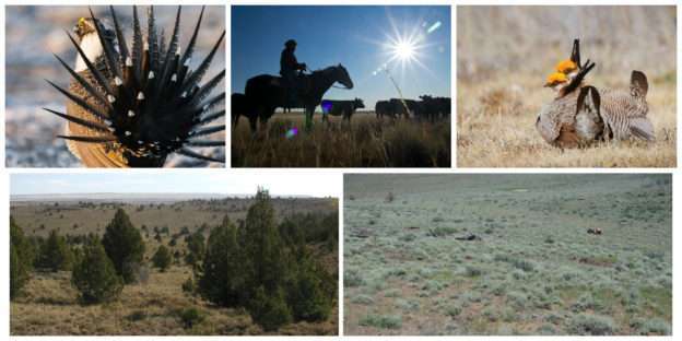
This month, the Society for Range Management’s (SRM) scientific journal, Rangeland Ecology & Management, released a special issue focused entirely on this landscape-level threat. Fifteen new research papers describe the impacts of the woody invasion of western rangelands, using grouse as a focal species to evaluate habitat restoration.

This new research contributes to a growing body of science demonstrating the impacts of woodland expansion on wildlife in the West. Using science to target conservation practices maximizes the return on investment, and helps managers and landowners fine-tune practices that benefit the bird and the herd.

For the USDA Natural Resources Conservation Service (NRCS), removing encroaching woody plants has long been a conservation priority through its Sage Grouse Initiative and Lesser Prairie-Chicken Initiative.

The greater sage-grouse in sagebrush country and the lesser prairie-chicken in the southern Great Plains both serve as barometers for the health of their respective regions, since these birds depend on large swaths of intact, healthy habitat to survive. NRCS uses science to target the best places and ways to work with ranchers to improve both working lands and habitat for these at-risk birds.

Since 2010, thousands of ranchers have made wildlife-friendly improvements to more than 6 million acres in the West—including removing woody plants from a total of 600,000 acres—benefiting sage grouse and prairie chicken while improving livestock forage on privately owned rangeland.

For example, one study in the new issue of SRM’s research journal shows that lesser prairie-chickens strongly prefer nest sites with less than 1 percent mesquite canopy cover and rarely use habitat where cover exceeds 15 percent. Another study shows that 86 percent  of sage grouse hens avoided conifer-invaded habitat, but that—after conifer removal—29 percent of tracked hens chose to nest in restored habitat.

Another research paper featured in this special journal issue shows that sagebrush-dominated landscapes hold snow longer than conifer-dominated lands, improving water availability during dry summer months – an invaluable ecosystem service in the arid West.

To ensure this new cutting-edge research reaches the broadest possible audience and informs rangeland practices far and wide, SRM, NRCS, and the Bureau of Land Management are partnering to live-stream presentations from a January 31 symposium held at the Society for Range Management’s annual conference in St. George, Utah.

The full-day symposium will feature 20 presentations on the latest findings about how woodland invasion is affecting grouse, wildlife, and people living in sagebrush and prairie ecosystems. All presentations will be free to watch on the Sage Grouse Initiative’s website.

To see the schedule of talks and find links to all research papers, visit the Sage Grouse Initiative website.
Helping Texas Ranchers and Wildlife, One Plan at a Time 

By Quenna Terry, NRCS Public Affairs Specialist

In the Panhandle of Texas, three things are certain: cattle will graze the grassy prairies, the wind will turn windmills on the plains, and Clint Rollins can be found helping ranchers improve wildlife habitat on their land.

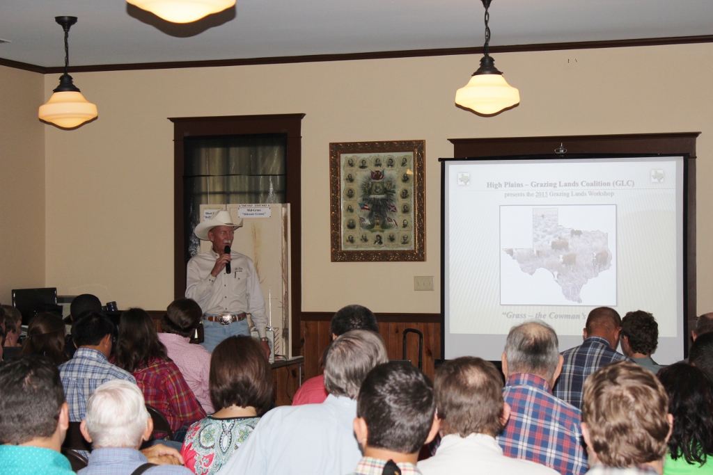
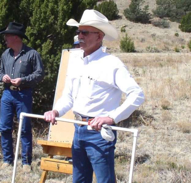
NRCS Range Management Specialist Clint Rollins, at a training session with landowners.

Rollins is a range management specialist in Amarillo for the USDA Natural Resources Conservation Service (NRCS). His 38 years of knowledge have helped fuel the success of Texas NRCS in engaging ranchers to voluntarily carry out habitat conservation practices that benefit the lesser prairie-chicken, with technical and financial assistance from the NRCS-led Lesser Prairie-Chicken Initiative (LPCI).

Lesser prairie-chickens once inhabited some 180,000 square miles of the southern Great Plains, in Colorado, Kansas, Oklahoma, New Mexico and Texas. They now occupy about 17% of that original range. In Texas, they’re found in northeastern and southwestern areas of the Panhandle region.

Rollins took the lead in conservation planning efforts in the northeastern Panhandle—particularly Lipscomb, Hemphill, Hansford, Ochiltree, and Gray counties—helping ranchers plan and adopt conservation practices most beneficial to wildlife habitat, while ensuring compatibility with livestock grazing.

Stan Bradbury, NRCS zone range management specialist said, “Rollins has spent years developing relationships with agricultural producers in the Panhandle region. It’s this kind of trust- and relationship-building that has allowed Rollins and other employees to work with these ranchers and conduct field work, data entry, and mapping.”

Guiding the Conservation Planning Process

LPCI is one of several landscape-level conservation initiatives within the Working Lands for Wildlife (WLFW) program, which works to restore at-risk wildlife species on private working lands, while providing landowners with regulatory predictability. Part of that process is developing a predictability plan.

 “‘Predictability plan’ is a fancy word for a conservation plan,” Rollins said.  “It’s a road map for a producer’s land management goals.”  Predictability plans have the added benefit of providing regulatory certainty to participating landowners.

NRCS Range Management Specialist Clint Rollins leads a range workshop in Oklahoma.

To develop a conservation plan, Rollins measures and assesses forage production, plant communities, plant composition and brush canopy transacts. “Our plant transects start with identification of Prickly pear, Yucca, [shinnery] oak, and other species to determine the grazeable acres,” Rollins said.

Using state-of-the-art mapping tools, Rollins first creates a map that identifies grazing and non-grazing areas.  “On an annual basis we want to know the forage demand with forage supply,” Rollins said. “If we didn’t have the technology we have today, it would take ten times as long to do conservation plans of this magnitude,” he said.

Rollins then recommends conservation practices that meet the needs of lesser prairie-chickens and the management goals of the participating landowner. These recommendations include such core practices as prescribed grazing and brush management.

Other practices can include prescribed fire, water development to better distribute grazing, weed control, wildlife-friendly structures such as ramps in water tanks, cover crops, and more.

“The most important practice is prescribed grazing to balance forage supply,” Rollins said.

From 2012 to 2015, Rollins helped seven ranchers on more than 40,000 acres. “I’ve worked with good stewards of the land who are livestock producers,” he said.  “The people I’ve worked with trust me, and they live on the land that I’ve worked on.”

Rollins has found that when most ranchers learn more about the resources they have on their land, they are eager to improve them to benefit both their ranching operation and the various wildlife species that make their home on their land.

Drought contingency planning is a key part of the conservation planning process, identifying management actions to take if drought conditions occur. Quick, carefully planned response to drought can reduce both financial and habitat impacts.

In 2012, following of one of the worst droughts in recent history, ranchers in the Panhandle region were panicked. Clay loam soils that produced 3,500-4,000 pounds of forage per acre in wetter years produced just 1,000-1,200 pounds in 2012.

 “I had to help calm the ranchers down,” Rollins said. “My job was to convince them to take a vacation and come back later.”  Wet weather following the drought improved grazing distribution.

According to Rollins, the land needed time to heal itself.  From 2012 through 2015 the grass cover made a comeback, and the ranchers could see a difference through the recovery options NRCS had to offer them.

In 2015 and 2016, through the efforts of Rollins and his colleagues in the Panhandle Region, the NRCS and Texas State Soil and Water Conservation Board, working through the Soil and Water Conservation Districts, provided conservation planning assistance to 27 private agricultural producers.

Their work resulted in conservation plans for 186,000 acres of grassland habitat through LPCI and WLFW technical assistance programs, with an additional 40,000 acres nearing completion.  In the coming year, predictability planning in the Panhandle region is estimated to exceed 200,000 acres.

NRCS to Expand Targeted Conservation Effort for Wildlife on Agricultural Lands

11 New Working Lands for Wildlife Projects Provide Opportunities for Producers to Restore, Protect Habitat

NEW FLORENCE, Missouri, Nov. 29, 2016 – From the northern bobwhite to trout and salmon, the U.S. Department of Agriculture (USDA) is adding dozens of new target species to its premier wildlife conservation effort that helps agricultural producers make wildlife-friendly improvements on working lands. USDA’s Natural Resources Conservation Service (NRCS) is adding 11 new projects to Working Lands for Wildlife (WLFW), the agency’s targeted, science-based effort to help producers restore and protect habitat for declining species on farms, ranches and working forests.

m13925_wlfw_projects

“Agriculture and wildlife both thrive together through landscape conservation,” said NRCS Chief Jason Weller, who toured a Missouri farm that has created young forest habitat to aid bobwhite and many other species. “Working Lands for Wildlife has delivered many unprecedented successes over the years, and we’re proud of our collective past achievements and look forward to continuing our work with America’s producers.”

With more than two-thirds of the continental United States under private ownership, bobwhite is one of many wildlife species that depend heavily on working lands for habitat and food. Projects focus on declining species that have needs compatible with agricultural practices and rural land management and that can benefit from conservation on private lands. Some of the new projects focus on one target species; others focus on a group of species. Projects include:

  • Northern Bobwhite in Grasslands, Virginia, Arkansas, Illinois, Indiana, North Carolina, Ohio, Missouri and Kentucky;
  • Northern Bobwhite in Pine Savannas, Georgia, New Jersey, North Carolina, South Carolina, Florida and Alabama;
  • Northeast Turtles, New Hampshire, Maine, Massachusetts, Rhode Island, Connecticut, New York and Vermont;
  • American Black Duck, Delaware, Maryland, Vermont and New Jersey;
  • Yazoo Darter, Mississippi;
  • Conasauga River Aquatic Species, Georgia and Tennessee;
  • Colorado River Aquatic Species, Texas;
  • Shorebirds of Louisiana Wetlands, Louisiana;
  • Cutthroat Trout, Colorado;
  • Sandhills Grasslands, Nebraska; and
  • Kenai Peninsula Salmon, Alaska.

When habitat is restored for these species, many others benefit. NRCS uses species as indicators of the health of the ecosystem at-large.

NRCS staff worked with conservation partners to identify new species and landscapes. Considerations included the compatibility of the species and agriculture, the network of available partners and the needs of the species.

Working Lands for Wildlife Conservation Model

wlfw_hf2-17So far, WLFW has helped producers restore 6.7 million acres of habitat for seven target species, such as the New England cottontail and greater sage-grouse. The U.S. Fish and Wildlife Service (FWS) determined last year that Endangered Species Act protections were not necessary for these species largely because of the voluntary conservation efforts on working lands.

“The future of wildlife, agriculture and rural ways of life depend on our collective ability to transfer our Working Lands for Wildlife model to more species and working landscapes,” Weller said.

Through WLFW, NRCS strategically invests where conservation returns are highest and measures how wildlife respond to management activities to refine conservation efforts.

Own or Manage Land? You Can Help.

NRCS provides technical and financial assistance to help producers adopt a variety of conservation practices on their land. NRCS staff help producers with a conservation plan and provide funding to cover part of the costs for adopting the practices. These practices are designed to benefit both the species and the agricultural operation.

By participating in WLFW, producers also receive regulatory predictability under the Endangered Species Act (ESA). Once enrolled, they may continue to implement their conservation efforts without fear of additional regulations.

To learn more about assistance opportunities, landowners should contact their local USDA service center.

New study measures fence collision mortality, informs conservation

Do barbed-wire fences pose a threat to lesser prairie-chickens? A recent study of more than 1,700 miles of livestock fences in Kansas and Colorado found little evidence of fence collision mortality. The study helps create a more detailed picture of threats to the lesser prairie-chicken populations across their range.

For resource managers working to conserve lesser prair0069amyerickson-copyie-chickens, it’s critical to accurately
identify threats and develop effective practices to address them. Scientific studies help provide the data that can help focus effort and funding on those practices that have a clear and significant positive effect.

Until recently, scientific data related to lesser prairie-chicken conservation has been limited. In recent years, however, as the range-wide population of this once-abundant prairie grouse dropped to historic lows, an unprecedented research effort has been underway to better understand the ecology, threats, and effective conservation of this species.

One of the overarching revelations of the emerging research is that threats and conservation strategies can vary across the prairie-chicken’s range. Effective management needs to accommodate and respond to these variations. Mortality due to fence collisions appears to be one such varying threat, perhaps corresponding with variations in fence density.

Like its cousin, the greater sage-grouse, the lesser prairie-chicken is a relatively low-flying bird, particularly when flushed. Many, though not all, research studies have shown that, for sage grouse, fences pose a significant threat and that fence-marking with vinyl tabs can reduce that mortality by more than 80%.

For lesser prairie-chickens, research has yielded less conclusive results. Several studies sampling various parts of the lesser prairie-chicken’s range in Kansas, Texas, Oklahoma, and New Mexico showed little or no fence-related morality. One study in Oklahoma showed high mortality related to fence collision. No studies have yet assessed the effectiveness of markers in reducing prairie-chicken mortality.

The new fence collision study, led by biologist Samantha Robinson of Kansas State University, came down conclusively on the side of minimal mortality from fences. Both by surveying fence lines and by tracking radio-marked birds, the research team found little fence-collision risk.

0268davidhaukosSpecifically, the research team documented only 1 fence-collision mortality in more than 12,700 recorded fence crosses by radio-tagged birds. During fence surveys, they found 3 carcasses that bore evidence of predator-related death. They also found 12 sites of potential collisions (dropped feathers), but could not conclusively document mortality of any lesser prairie-chicken due to a fence collision.

So how does this study help inform lesser prairie-chicken conservation practices? Current management recommendations for the species focus on the studies that indicated a significant threat from fence collision. Because of that, federal agencies like the Natural Resources Conservation Service, which leads the Lesser Prairie-Chicken Initiative, have required and provided financial assistance to mark and/or remove fences as part of conservation management planning.

Read the fence collision research report.

The report from Robinson’s team suggests that, given the low incidence of fence collisions for prairie-chickens in low-density fence areas (< 2 km of fence per km2), marking fences in such areas uses resources that could be more effectively applied to improving the quality and quantity of prairie habitat.

“Hopefully given the results of this study, the time and money invested in marking fences can be refocused to grassland management and protection and restoration of farms and ranches,” said Robinson.

The team additionally recommended that land managers aim to maintain low fence densities to avoid increasing risk to lesser prairie-chickens, such as what is found in Oklahoma.

U.S. Fish and Wildlife Service Delists Lesser Prairie-Chicken in Accordance with Court Order

The U.S. Fish and Wildlife Service (FWS) yesterday fulfilled a court ruling that had vacated its Endangered Species Act (ESA) listing decision, by officially removing the lesser prairie-chicken from the Federal List of Endangered and Threatened Wildlife.

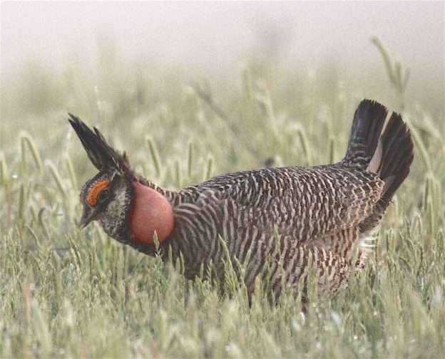
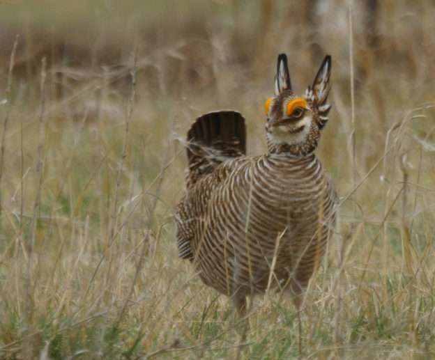
Lesser prairie-chicken (photo Jeremy Roberts, Conservation Media)

Lesser prairie-chicken (photo Jeremy Roberts, Conservation Media)

According to the FWS, this administrative action and the decision not to appeal the court’s ruling do not constitute a biological determination on whether or not the lesser prairie-chicken warrants federal protection. The Service is undertaking a thorough re-evaluation of the bird’s status and the threats it faces using the best available scientific information to determine anew whether listing under the ESA is warranted.

“The storied prairie landscape of the Southwest is of tremendous economic and cultural importance. It is also a critical area for the birds, mammals, reptiles and other animals that rely on this unique habitat,” said Service Director Dan Ashe.

“Responding to this court ruling by removing the bird from the Federal List does not mean we are walking away from efforts to conserve the lesser prairie-chicken. Far from it,” Ashe said. “We are undertaking a new status review to determine whether listing is again warranted, and we will continue to work with our state partners and others on efforts to protect vital habitat and ensure this flagship of the prairies survives well into the future.”

On June 9, 2014, the Permian Basin Petroleum Association and several New Mexico counties filed a lawsuit challenging the Service’s 2014 listing of the lesser prairie-chicken as a threatened species under the ESA. In September 2015, the court ruled in favor of the plaintiffs and vacated the final listing rule, effectively ending ESA protections for the bird.

The ruling had the effect of also invalidating the Service’s rule under section 4(d) of the ESA that tailored the regulations governing take of the species under the ESA to focus on those activities that are threats to the species’ survival.

Despite the ruling, the Service continues to engage in a number of major initiatives to conserve lesser prairie-chicken populations, including the Service’s Partners for Fish and Wildlife program, the Lesser Prairie-Chicken Range-wide Conservation Plan developed and administered by the Western Association of Fish and Wildlife Agencies, and the NRCS-led Lesser Prairie Chicken Initiative (LPCI).

According to LPCI Coordinator Jon Ungerer, the delisting will not affect the LPCI partnership’s strong commitment to improving habitat for lesser prairie-chickens.

“LPCI will continue to provide technical and financial assistance to landowners interested in voluntarily improving grassland health using proven conservation methods.” said Ungerer.

Once abundant across much of the five range states of Texas, New Mexico, Oklahoma, Kansas and Colorado, the lesser prairie-chicken’s historical range of native grasslands and prairies has been reduced by an estimated 84 percent.

Lesser prairie-chicken populations need large tracts of intact, high-quality prairie to survive and reproduce. As such, the lesser prairie-chicken serves as a key indicator of the health of native grasslands, which support regional ranching economies and many native wildlife species, such as migratory birds, scaled quail, pronghorn and mule deer.

Latest Aerial Survey Documents Stable Lesser Prairie-Chicken Population Trends

The latest lesser prairie-chicken aerial survey shows bird population trends remain stable after five years of aerial survey data collection. Conducted by the Western Association of Fish and Wildlife Agencies (WAFWA), the surveys indicated an estimated breeding population of 25,261 birds this year which scientists say is not significantly different from the 29,162 birds estimated in 2015 given the variability in the survey methodology. This spring’s breeding population remains significantly larger than the 17,616 birds estimated in 2013 following two years of severe drought.

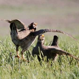
Lesser prairie-chickens on a lek in New Mexico. Nick Richter photo

Lesser prairie-chickens on a lek in New Mexico. Nick Richter photo

Lesser-prairie chickens inhabit four ecoregions in five states: Colorado, Kansas, New Mexico, Oklahoma and Texas.  Their numbers regularly fluctuate up and down from year to year due to changes in habitat conditions, mainly influenced by rainfall patterns. The surveys this year indicated apparent population increases in the shinnery oak ecoregion of eastern New Mexico and the Texas Panhandle and the sand sagebrush ecoregion of southeast Colorado and southwest Kansas.  Lesser prairie-chicken populations in these regions experienced the most decline as a result of the 2011-2012 drought.

Aerial surveys recorded population decreases in the mixed-grass prairie ecoregion of the northeast Panhandle of Texas, northwest Oklahoma and south-central Kansas, and the short-grass prairie region of northwest Kansas.

“Just as with last year’s population increase, we shouldn’t read too much into short-term fluctuations over one or two years,” said Bill Van Pelt, WAFWA grassland coordinator. “Lesser prairie-chickens inhabit a large geographic landscape with highly variable weather patterns, so we expect to see annual and regional population fluctuations.”

Van Pelt added that these numbers show the importance of maintaining good prairie habitat for long-term population stability. “Voluntary conservation efforts like the range-wide plan help to ensure that suitable habitat is available so these population increases can occur when weather conditions are suitable,” he said.

Brad Odle (right) is one of four WAFWA regional biologists working with private landowners to improve lesser prairie-chicken habitat.

Brad Odle (right) is one of four WAFWA regional biologists working with private landowners to improve lesser prairie-chicken habitat.

WAFWA oversees the Lesser Prairie-Chicken Range-wide Plan (RWP) in collaboration with state wildlife agencies of Texas, New Mexico, Oklahoma, Kansas and Colorado. The plan was developed to ensure long-term viability of the lesser prairie-chicken through voluntary cooperation by landowners and industry. Industry contributions support conservation actions implemented by participating private landowners. To date, industry partners have committed over $60 million in enrollment and mitigation fees to pay for conservation actions, and landowners across the range have agreed to conserve over 130,000 acres of habitat through the RWP’s 10-year and permanent conservation agreements.

WAFWA is a partner organization in the Lesser Prairie Chicken Initiative (LPCI), a conservation partnership launched by the Natural Resources Conservation Service in 2010. Since its inception, LPCI has enrolled more than 450 landowners in conservation agreements to improve grassland habitat on more than one million acres.

LPCI, WAFWA, and other partner organizations offer a range of voluntary technical and financial support to landowners to create habitat conditions that benefit lesser prairie-chickens and support long-term viability of agricultural operations.

“With continued improvement in nesting and brood-rearing habitat associated with good weather conditions and private landowner conservation actions, we are optimistic about the lesser prairie-chicken’s future,” said Alexa Sandoval, chairman of WAFWA’s Lesser Prairie-Chicken Initiative Council. “Habitat conservation and species recovery is a marathon, not a sprint. We appreciate the continued commitment of all of our partners in our ongoing conservation efforts.”

New Magazine Highlights Conservation Successes on Working Lands, Including LPCI

From ranchers in the West to forest managers in the East, private landowners are voluntarily conserving habitat for wildlife, helping species rebound and recover. These successes—including the Lesser Prairie-Chicken Initiative’s work conserving grassland habitat in the southern Great Plains—are the focus of the new Working Lands for Wildlife (WLFW) magazine.

Read the magazine.WLFWmagazine

WLFW is a Natural Resources Conservation Service (NRCS) partnership initiative that targets species whose decline can be reversed and benefits other species with similar habitat needs. Species include the lesser prairie-chickenNew England cottontailSouthwestern willow flycatchergreater sage-grousegopher tortoisebog turtle and golden-winged warbler.

Private lands are essential for providing habitat for nearly two-thirds of all species listed as threatened or endangered under the Endangered Species Act (ESA). Through WLFW, NRCS works with conservation partners and private landowners to restore populations of declining wildlife species, provide regulatory certainty and strengthen and sustain rural economies. The nation’s landowners—farmers, ranchers and forest managers—provide not only food and fiber for the world but also include a variety of environmental benefits, including habitat for wildlife.

WLFW uses a voluntary, innovative approach to benefit high-priority habitat for seven species of wildlife that are declining, candidates for listing or listed under the Endangered Species Act (ESA).  WLFW works with agricultural producers to create and improve wildlife habitat with regulatory predictability from the U.S. Fish and Wildlife Service.


Permanent Protection for Prairie-Chicken Habitat in Kansas

The Western Association of Fish and Wildlife Agencies (WAFWA) has finalized the purchase of approximately 30,000 acres of high-quality lesser prairie-chicken habitat in southwest Kansas. The permanent protection and long-term conservation of lesser prairie-chicken habitat is an important goal of the Lesser Prairie-Chicken Range-wide Conservation Plan. Funding for this acquisition comes from the voluntary contributions of industry partners that are enrolled in the range-wide plan.

0297(David Haukos) copy

Lesser prairie-chicken male during courtship display (photo: David Haukos)

“The acquisition of Sunview Ranch is a significant positive development to conserve the lesser prairie-chicken,” said Alexa Sandoval, Director of the New Mexico Department of Game and Fish and Chairman of the Lesser Prairie-Chicken Initiative Council.

“This transaction involved a willing seller of land that contains prime lesser-prairie chicken habitat and furthers our goal of providing a stronghold of at least 25,000 acres in each of the ecoregions where the lesser prairie-chicken is still found. We commend all of our partners for their continued commitment to conservation of the lesser prairie-chicken,” Sandoval said.

The range-wide plan is a collaborative effort of WAFWA and the state wildlife agencies of Kansas, Colorado, New Mexico, Oklahoma and Texas. It was developed to ensure conservation of the lesser prairie-chicken through voluntary cooperation by landowners and industry. The plan allows agriculture producers and industry to continue operations while reducing impacts to the bird and its grassland habitat.

The Sunview Ranch (formerly Tate Ranch) is in the sand sagebrush ecoregion, which covers portions of Kansas, Colorado and Oklahoma and once contained the highest density of lesser prairie-chickens in the country. The dominant vegetation on rangelands in the region is sand sagebrush which is a native shrub typically associated with deep sandy soils in dune landscapes. Livestock grazing is the primary land use on rangeland throughout the sand sagebrush region, and through grazing leases, will continue to be used as a management tool on the Sunview Ranch.

“This property is one of the largest remaining contiguous tracts of sand sagebrush prairie in the region,” said Jim Pitman, Conservation Delivery Director for WAFWA. “Conserving this property in perpetuity ensures that it will remain a working ranch and continue to provide habitat for the lesser prairie-chicken in the portion of its range where the population has declined the most.  Prescribed grazing is the core management practice for lesser prairie-chickens, and we will be implementing it on the ranch to conserve and enhance habitat for the species.”

Western Livestock Journal Showcases LPCI Strategy

LPCI’s new Conservation Strategy takes centerstage in the 

The story, Good for the Bird, Good for the Herd, by WLJ Managing Editor Kevin Halladay, begins this way:

In what seems to be a welcomed proliferation of private partnership efforts, a new strategy to improve habitat for the lesser prairiechicken focuses on what ranchers have been saying for decades; grazing required!

0302(David Haukos),webUSDA’s Natural Resources Conservation Service (NRCS) released a three-year conservation strategy for the lesser prairie-chicken at the end of April. Noting that the bird’s habitat is located almost exclusively on privately-held lands, the emphasis on partnering with landowners in ways that are mutually beneficial was strong.

“About 95 percent of the lesser prairie-chicken range falls on private lands, making conservation efforts on these productive family farms and ranges pivotal to the lesser prairie-chicken’s success,” wrote Jason Weller, NRCS Chief, in the plan’s introduction.

“Conservation efforts are designed to be win-win, benefitting the bird while improving the long-term sustainability of agricultural operations. New research demonstrates that sustainable grazing and lesser prairie-chicken conservation are not only compatible, but interdependent.”

The strategy seeks to involve an additional 500,000 acres of private land in the bird’s habitat to add to the roughly 1 million acres already involved in voluntary conservation efforts. The scope of this goal extends out to 2018 when the current farm bill expires. Generally speaking, strategies revolve around improving grassland health through prescribed grazing and judicious use of fire as management tools, and the removal of invasive woody plants.

“Across the country, we’re seeing firsthand how farmers, ranchers and forest landowners are voluntarily stepping forward to aid wildlife species,” Weller added in the group’s announcement of the plan.

“By adopting conservation systems, agricultural producers in the southern Great Plains can restore top-notch lesser prairiechicken habitat while also making working lands more productive and resilient to wildfire and climatic extremes.”

New tool turns science into actions for working lands and wildlife

Today, the Sage Grouse Initiative, led by USDA’s Natural Resource Conservation Service, is unveiling a new tool to catalyze and improve habitat conservation efforts across the western United States. The SGI Interactive Web Application is free and available to the public, presenting cutting-edge geospatial data covering 100 million acres. The SGI science team has developed an easy-to-use web application that helps visualize, distribute, and interact with information about the sagebrush-steppe ecosystem.

Like the Southern Great Plains Crucial Habitat Assessment Tool map used land managers in the grasslands habitat ecoregions within the Lesser Prairie-Chicken Initiative action area, the SGI Interactive Web Application will help resource managers manage sagebrush-steppe habitat efficiently and effectively.

24589616893_d2de74a21e

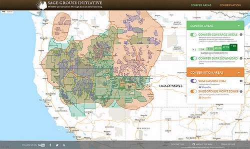
The SGI Interactive Web Application enables conservationists to help plan the best conservation efforts to restore sage grouse habitat.

Developed in partnership with the University of Montana and others, SGI used Google Earth Engine to build a new interactive online map that, for the first time, combines layers of related data to better target invasive species damaging habitat and rangeland in 11 states. The new app currently allows farmers, ranchers, conservationists and other partners to analyze data on the encroachment of conifers and cheatgrass on key rangeland. The SGI science team will continue to add more layers to the map as they are developed—such as data on fence collisions and subdivision risk—to help address threats to sage grouse and the 350+ species that depend on healthy sagebrush-steppe habitat.

The goal is to put information directly into the hands of the resource managers who need it. The layers available now include high-resolution tree canopy cover and ecosystem resilience and resistance index data across the range of sage grouse. All data can be easily downloaded, allowing custom analysis to make the most difference for working lands and wildlife.

“By putting cutting-edge products at the fingertips of practitioners and landowners, it helps us more quickly turn science and technology into targeted action on-the-ground,” said Jeremy Maestas, NRCS regional biologist.

Brady Allred, a rangeland specialist with University of Montana who developed the new web app, said he is excited that SGI will continue to build on the tool over time.

“Since we focused on such a large area, we are able to provide the big picture—it’s a better view of what’s occurring across boundaries, so that each effort supports the greater goal and helps reduce future threats,” Allred said.

The newly created tree canopy cover layer, developed by Michael Falkowski at Colorado State University, shows where conifers are degrading critical habitat on the range. SGI and partners can use this information to target projects that improve sage grouse habitat by removing invading conifers when the trees are young and more easily eradicated. Another layer now available provides an index of ecosystem resilience and resistance to cheatgrass based on underlying soil temperature and moisture, which will help resource managers protect and restore crucial sagebrush ecosystems.

All of the information can be easily visualized on top of physical maps or the latest satellite imagery. Users can quickly identify and compare areas of concern, evaluating potential restoration or prevention opportunities. Data can be imported from the web application directly into GIS software, which allows the public to customize the information for land management or conservation purposes. Data for individual counties can be downloaded using these simple instructions.

The interactive web application aligns with the Sage Grouse Initiative 2.0 investment strategy, a four-year $211 million effort to help conserve sagebrush habitats in 11 Western states.

“Our Sage Grouse Initiative 2.0 investment strategy has science at its core, and this new website brings crucial information to conservation planners to enable them to craft the best plan for specific locations,” NRCS Chief Jason Weller explained. “Not only will this be pivotal for NRCS staff, but for our partners as well.”